
Features TopoTool: Topographic Mapper
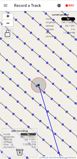
This application allows you to survey land-surfaces with your android device.
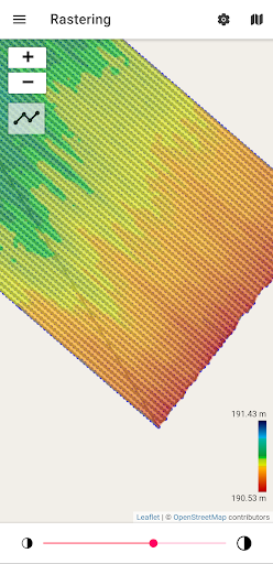
This data will be converted into a digital raster model which is useful for land analysis/simulation/design.
Those raster models can be exported and for example, used in QGISsupported inputs:- internal GPS- Bluetooth GNSS (RTK) receiver (NMEA)- USB-Serial GNSS (RTK) receiver (NMEA)- CSV files (EPSG:4326) with latitude, longitude, and elevation- GPX filesupported outputs:- GPX file- Ascii Grid (EPSG:3857, EPSG:4326, UTM)- Image (.png) and world file (.pgw)
Fitness Tracking
Track your workouts and monitor your health metrics.
Travel Features
Plan and manage your travels with ease.
Smart Home
Control and monitor your home with smart features.
See the TopoTool: Topographic Mapper in Action
Get the App Today
Available for Android 8.0 and above